Tool Description
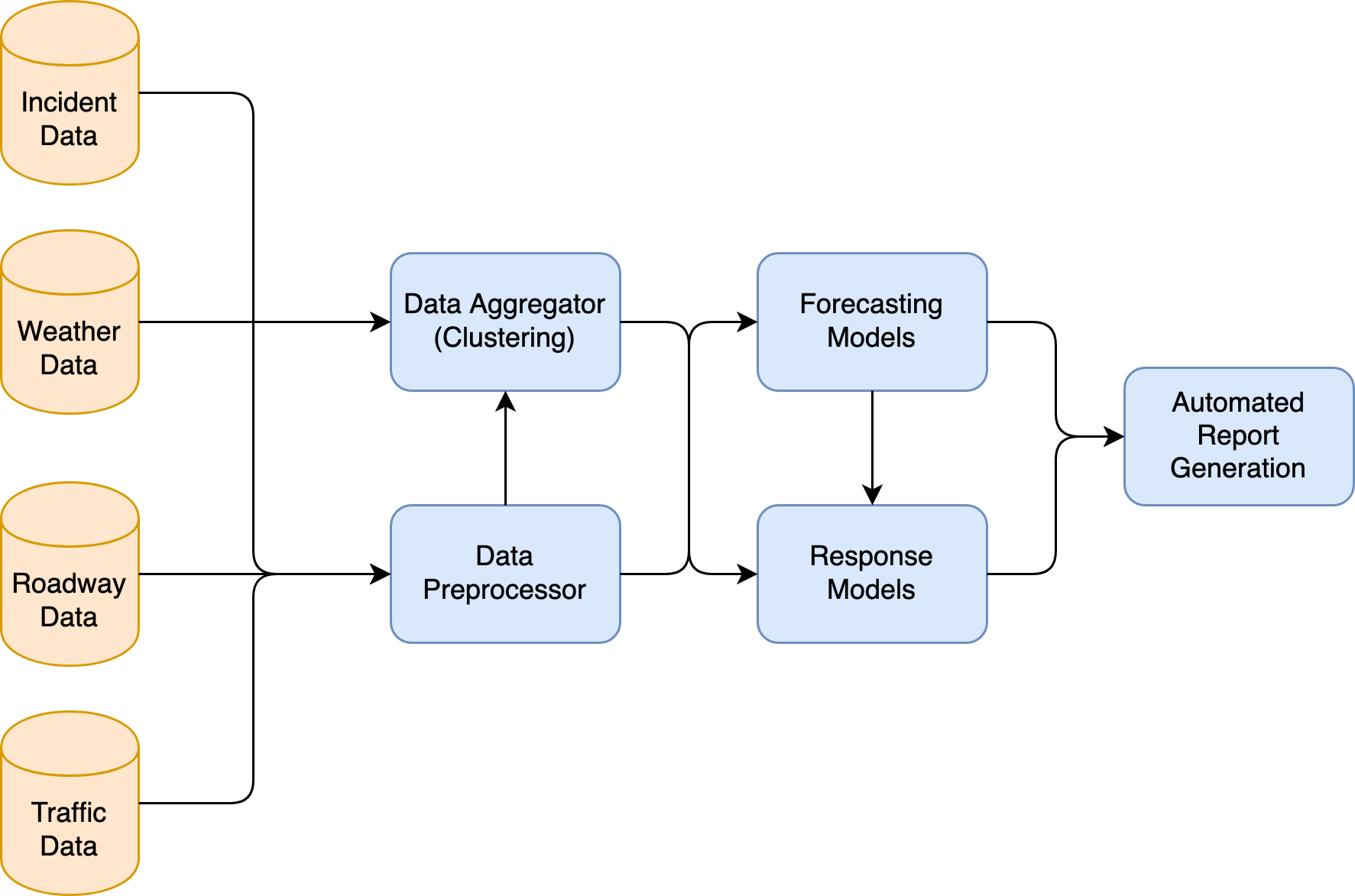
Fig. 1 shows a high-level overview of how StatResp works. It combines data from various sources like traffic, weather and roadway geometry to create forecasting models of spatial-temporal incident occurrence. The forecasting models are often aided by clustering models, which finds similar spatial segments to improve forecasting. The output of the forecasting model is fed to response optimization algorithms that find optimal allocation and dispatch decisions. Finally, outputs from both forecasting as well as response models are collected by an automated report generator, which creates reports for the end-user.